Forested valleys and floodplains form the low ground of Burigi-Chato National Park, where drainage lines running north between the ridges carry ribbons of riverine forest and open out into seasonally flooded grassland. Game drives concentrate here in the dry months because this is where the water and the grazing herds are. Burigi-Chato spans 4,707 square kilometres of northwestern Tanzania, and these deeply set valleys hold habitats found nowhere else inside the park.
Some of the forest in the steepest gullies is a genuine relict, left over from a wetter past.
Where the Forested Valleys Sit on a Burigi-Chato Safari
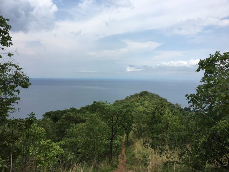
The structure of a Burigi-Chato safari follows the structure of the park, and that structure is ridges and valleys running north to south. Rivers flow north along the drainage lines between the ridges. Lake Burigi occupies one of them. Where the valleys cut deepest, the sides steepen into gullies and the vegetation changes.
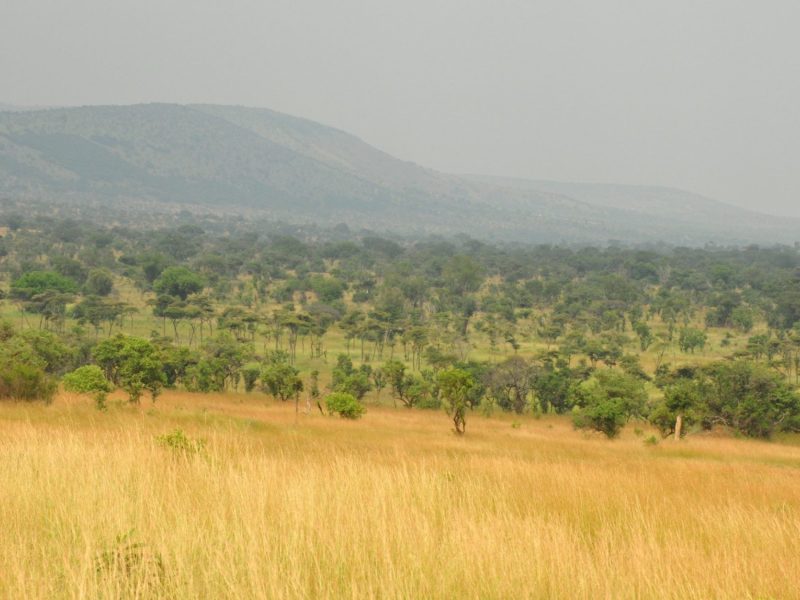
These valleys are narrow. You can drive along a ridge in open woodland, drop three hundred metres of track, and find yourself under closed canopy with a stream running beside you. Then the valley opens, the trees fall back, and you are on floodplain grass.
That sequence is repeated across the park. Learning to read it is the single most useful thing a visitor can do here.
Guinea-Congo Forest Remnants in the Steep Gullies
The most interesting vegetation in Burigi-Chato is in the places hardest to reach. In the steeper valleys and gullies there are surviving patches of Guinea-Congo forest, the western African forest type that once extended much further east than it does today. Relict sclerophyll forest also holds on in sheltered pockets.
These are refugia. They survive because the gullies stay damp and shaded when the surrounding country dries out, and because fire struggles to run through them. Each patch is small, and collectively they hold plants and birds absent from the woodland a few hundred metres above.
If you have a botanical or birding interest, ask your guide by name about the gully forest rather than the general woodland. These fragments are the reason the park’s species list is longer than its size and dryness would predict, and most visitors never see one.
Access is often on foot, since vehicle tracks rarely drop into the tightest gullies. A guided walk is the practical way in.
Riverine Forest and Fever Tree Woodland Tours
Along the watercourses themselves the forest is riverine rather than relict, a corridor of taller trees following the water through country that is otherwise open woodland. Palms stand along parts of the lake valleys, which is one of the more distinctive sights in the western half of the park.
East of the ridges, where the ground slopes toward Lake Victoria and the soils are poorer, large stands of Acacia xanthophloea take over. These are the fever trees, yellow-green barked and growing in the wetter, low-lying ground. Early European travellers associated them with malaria, which is where the name came from, though the mosquitoes rather than the trees were the problem.
Fever tree stands are excellent for wildlife viewing. The canopy is open, the ground beneath is often clear, and animals sheltering under them are visible in a way they are not in thicker woodland.
Floodplain Game Drive Safaris and Seasonal Grazing
The floodplains are the engine of the park’s game viewing, and they operate on an annual cycle you should plan around.
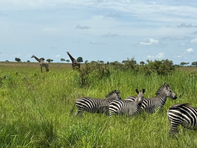
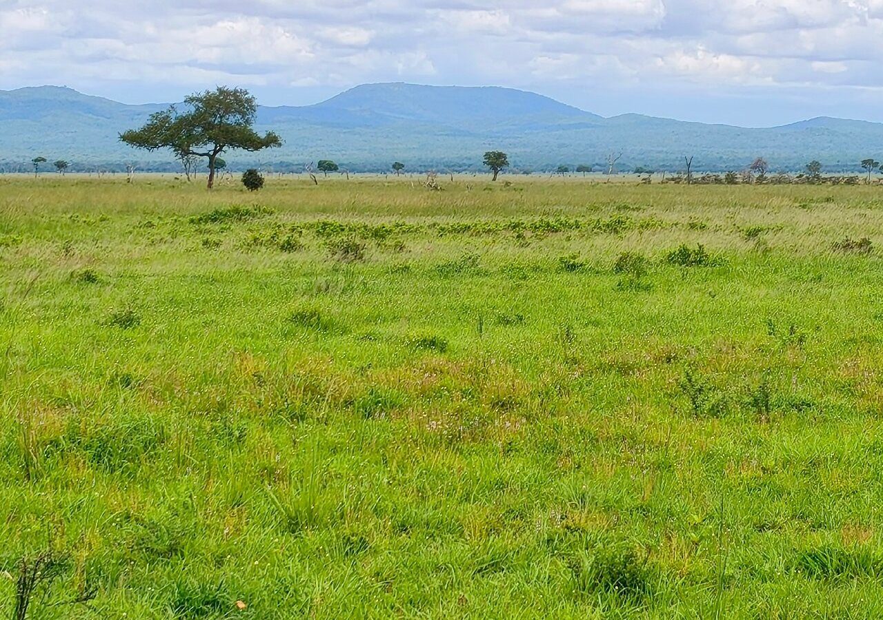
After each rainfall peak the low ground floods and the grass grows fast and green. Grazers move out from the woodland to use it: buffalo in large herds, zebra, topi, impala, eland and reedbuck. Defassa waterbuck favour the wetter margins and are among the more reliable large antelope near water here.
As the dry months advance, the floodwater retreats and the grass is grazed down. Animals concentrate closer to the permanent water at Lake Burigi and along the Kagera drainage, and the floodplain edges become the best place in the park to sit and wait.
Elephant use these low corridors heavily, moving between drainage systems along routes that connect this area to the wider Moyowosi country to the south.
In a park this large with recovering wildlife numbers, the floodplain edge in September does more for your sightings list than a hundred kilometres of woodland driving.
Predator Watching Along the Valley Floors
Where grazers concentrate, predators follow, and the valley floors are the most productive ground for carnivores in Burigi-Chato.
Lion, leopard and spotted hyena are all present, along with jackal and serval, and cheetah have been reported. Numbers are recovering rather than high, a legacy of heavy poaching pressure during the area’s decades as a game reserve, so any predator sighting here is a good day rather than something to expect.
Leopard use the riverine forest corridors as cover and as movement routes, which makes the tree line along a watercourse worth scanning slowly. Lion favour the open floodplain edges where they can watch grazing herds. Serval hunt the long grass at the margins and are more often seen at dusk.
Night game drives are permitted in Burigi-Chato, which is unusual among Tanzanian parks, and the valley floors after dark are where they pay off. Several of the smaller nocturnal carnivores are far easier to find with a spotlight than in daylight.
Birdwatching Safaris in the Valleys and Floodplains
Three bird communities sit within a short distance of each other here, and a birdwatching safari that works all three produces a much longer list than one that stays in the woodland.
Gully forest holds the forest species, including greenbuls, forest robins and canopy feeders that do not occur in the miombo above. Riverine corridors hold kingfishers, herons and a range of woodland edge birds. Floodplain grassland holds crakes, storks, lapwings and the open-country raptors hunting over them.
Saddle-billed stork work the shallow floodplain edges. Wattled crane, wattled lapwing and Senegal lapwing are recorded on the open wet ground. African fish eagles are at unusually high density along the water. Cattle egret follow the grazing herds, and village weaver colonies hang over the watercourses.
From around November, Eurasian migrants arrive and the floodplain bird numbers climb through the northern winter.
Guided Nature Walks Through the Valley Forest
TANAPA offers walking safaris in Burigi-Chato with an armed ranger, split into short walks of one to four hours and long walks above four hours. Valley forest is where walking gives you most, because a vehicle cannot get into the good bits and because forest rewards slow movement.
On foot in a gully you notice the temperature drop, the change in bird calls, the leaf litter, the root systems holding the slope together. Guides read tracks in the damp ground beside the stream, which in these valleys often means something walked through overnight that you would never otherwise know about.
Night nature walks are offered in applicable parks and are worth asking about here.
Closed boots, long trousers and insect repellent. Damp valley floors mean mosquitoes and biting flies, and the ground is uneven under leaf litter.
Photography Tours in the Forested Valleys
Forest and floodplain present opposite technical problems, and moving between them in one morning is a real test of a camera.
Under gully canopy the light is dim and green, contrast is high in patches, and you will be working at high ISO with wide apertures. Out on the floodplain the light is flat and bright, backgrounds are clean, and reach matters more than speed.
The floodplain edge at dawn is the frame most people come away with: mist sitting on the grass, the tree line behind, animals moving out of cover. It happens in a narrow window and it is worth the early start.
Drones are prohibited across all Tanzanian national parks, and commercial filming requires a permit arranged in advance.
How the Valleys Connect the Park’s Wider Water System
These drainage lines are not isolated. Rivers here flow north into the Kagera system, which runs along the western boundary of the park and is the largest single tributary of Lake Victoria, carrying water from the most distant headwater of the Nile.
To the east the ground falls toward Lake Victoria itself, meeting the lake around Bunkwe Bay. To the west lie the Kagera swamps along the Rwandan border, and beyond them Akagera National Park protects the far bank of the same system.
The valleys are also movement corridors for wildlife, which is much of the argument for merging the former Burigi, Biharamulo and Kimisi reserves into a single national park in 2019 rather than managing them separately.
Best Time for a Valley and Floodplain Safari
Two rainfall peaks shape the year, one around November and December and a second in March and April, with dry weather from June through September.
June to September: The best game viewing window. Floodwater has retreated, grass is grazed down, and animals concentrate on the permanent water and the floodplain edges. Valley tracks are firm.
October to December: Rains return, floodplains fill, and grazing herds disperse across fresh grass. Birding improves sharply as migrants arrive. Gully forest is at its most alive.
January to February: A drier gap between the peaks. Grass is high, sightings are patchier, and the park is almost empty of visitors.
March to May: The heavier rains. Floodplains are genuinely flooded, valley crossings become difficult, and access rather than wildlife is what limits your day.
Getting to the Valleys and Floodplains for Your Safari
Mwanza is the main road gateway, around 150 kilometres out with a drive of three to five hours. Bukoba is nearer at two to three hours. Chato town sits roughly 40 kilometres from the Katete Gate.
By air, Chato and Bukoba both take domestic flights, and private charters can reach an airstrip near the Nkonje ranger post beside Lake Burigi or the Biharamulo airstrip. The Nkonje option puts you closest to the lake valley system.
A 4×4 is necessary. Valley crossings and floodplain margins are the first places to become impassable when wet, and even in the dry season the descents into the gullies need clearance. Carry your own drinking water, and fuel before entering.
Frequently Asked Questions About a Valley and Floodplain Safari
What does it cost to visit Burigi-Chato?
The conservation fee currently runs at US$30 per person per day for non-East African adults aged sixteen and above and US$10 for children aged five to fifteen. Expatriates and Tanzanian residents pay US$15 and US$5. East African Community citizens pay TZS 5,000 and TZS 2,000, and children under five are free. This park has no seasonal fee variation, and 18 percent VAT applies on top of every TANAPA charge.
How much are guided walks and night drives in the valleys?
Short walking safaris of one to four hours are currently US$20 per adult and US$10 for children aged twelve and over, with long walks above four hours at US$25 and US$15. Night nature walks are US$10 per adult. Night game drives, which are permitted in Burigi-Chato, run at US$50 per adult and US$25 per child aged five to fifteen. A park guide is US$20 per group per day.
When do the floodplains actually flood?
Following each of the two rainfall peaks, so roughly November into December and again from March into May. The March to May flooding is the heavier of the two and is what makes those months difficult for vehicle access. Water drains off through June, the grass is grazed down over July and August, and by September the floodplain edges are the most productive ground in the park.
Can I walk into the gully forest?
Yes, on a guided walking safari with an armed ranger, which is the only way it is permitted. Vehicle tracks rarely drop into the tightest gullies, so walking is also the practical way in. Wear closed boots with ankle support, expect uneven footing under leaf litter, and take insect repellent, since the damp valley floors hold mosquitoes and biting flies through much of the year.
What is the Guinea-Congo forest doing in a Tanzanian savannah park?
Surviving. These are relict patches, remnants of a forest type that once extended much further east during wetter climatic periods and now persists only where conditions stay damp and shaded enough. Steep gullies protect them from fire and from drying out. Each fragment is small, but together they hold plants and birds that do not occur in the surrounding woodland, which is why they matter out of proportion to their area.
Are the floodplains the best place to see predators?
They are the most productive ground, since predators follow grazing concentrations, but no sighting is guaranteed anywhere in this park. Lion, leopard, spotted hyena, jackal and serval are present and numbers are recovering from years of heavy poaching pressure. Scan the riverine tree line for leopard and the open floodplain edges for lion, and treat any big cat as a strong day rather than a plan.
Where should I stay to reach the valleys early?
The Nkonje ranger post area beside Lake Burigi has bandas and a tented camp with basic amenities, and there are public and special campsites near the water. TANAPA rest house, cottages and park-provided tents at Burigi-Chato currently run at around US$35 per adult per night for cottages and rest house and US$30 for park tents, with public campsites at US$30 per adult and special campsites at US$50. Staying inside is what makes a dawn floodplain drive practical.
Booking Your Burigi-Chato Trip
The safari companies and tour operators listed on this website put trips like this together for a living and know which camps, guides and routes actually deliver. We are an independent guide to Burigi-Chato; we do not book or sell tours ourselves.
When you are ready, arrange your safari, tour or holiday with one of the recognised operators listed here. Tell them your dates and what matters most, and a real person, not a form, will handle the itinerary, park bookings and logistics for you.