The merged Burigi, Biharamulo and Kimisi area became a single protected unit when Burigi-Chato National Park was gazetted in 2019, bringing three neighbouring game reserves and the Chato district ground under one management body for the first time. Visitors now buy one park permit for terrain that once needed three. The combined area covers 4,707 square kilometres in Tanzania’s Kagera and Geita regions, running from Lake Victoria in the east to the Rwandan border in the west.
Knowing how the pieces fit explains a lot about what you see there now.
What the Merged Area Covers on a Burigi-Chato Safari
A Burigi-Chato safari crosses ground that was administered as separate reserves for most of the last fifty years, and the seams are still visible in the terrain and in the wildlife.
The three former reserves sat side by side across the Kagera Region, together making up what conservation literature refers to as the Burigi-Biharamulo-Kimisi complex. Published areas differ between sources, which is common for protected areas whose boundaries were adjusted over decades. The most internally consistent set gives Burigi at roughly 2,941 square kilometres, Kimisi at around 1,030 and Biharamulo at about 731, which totals close to the 4,702 square kilometres often quoted for the complex. Other sources put Burigi nearer 2,200 and Biharamulo nearer 1,300. Treat any single figure with caution.
Administratively the reserves spanned several districts. Burigi covered Biharamulo, Karagwe, Muleba and Ngara. Biharamulo covered Biharamulo and Muleba. Kimisi covered Karagwe and Ngara. The Chato ground lies in Geita Region to the east.
The Three Former Game Reserves Before the Merger
All three were gazetted as game reserves in the 1970s, part of Tanzania’s post-independence expansion of protected land, and for decades they were managed under the wildlife authority rather than the national parks body.
Game reserve status in Tanzania permits regulated hunting and certain extractive uses that national park status does not. Limited human activity such as fishing and honey gathering coexisted with wildlife across parts of this ground. Ranger coverage was thinner than in the national parks, and the three reserves were run as separate management units with their own boundaries and their own staff.
Burigi and Biharamulo were at one stage joined as a single management unit for practical purposes, which gives some sense of how administratively fluid the arrangement was. Rumanyika, a smaller reserve of around 245 square kilometres to the north, sat in the same complex and has since become Rumanyika-Karagwe National Park in its own right.
If you are reading older sources about this area, they will use the game reserve names rather than the park name. Burigi Game Reserve, Biharamulo Game Reserve and Kimisi Game Reserve all describe ground that is now inside Burigi-Chato National Park.
How the 2019 Gazettement Created a Single Safari Destination
The upgrade came in two steps. In May 2018 the three reserves were promoted alongside five other areas for elevation to national park status. The formal commissioning of Burigi-Chato National Park followed on 9 July 2019, presided over by President John Pombe Magufuli.
The legal mechanism was the Wildlife Conservation Act of 2009, which empowers the minister responsible for natural resources to declare and regulate protected areas, including transitions from game reserve to national park. Management passed from the wildlife authority to Tanzania National Parks.
The name combines two sources. Burigi comes from the lake at the heart of the western sector. Chato comes from the district in Geita Region on the Lake Victoria side, which was integrated into the same protected zone.
That single change altered what happens on the ground more than the paperwork suggests. Hunting stopped. Ranger presence increased. A tourism fee structure came into force, and the area entered the TANAPA booking system, which is why you can now buy a permit online for a place that had almost no visitor infrastructure a decade ago.
The Refugee Years and What They Mean for Safaris Today
No honest account of this park skips the 1990s, and knowing this history explains why wildlife densities here sit well below what the habitat could support.
Following the Rwandan civil war and the genocide of 1994, several hundred thousand refugees crossed into this part of Tanzania. The main camp was sited on the very edge of Burigi Game Reserve. Demand for protein outstripped what rations supplied, and wild meat hunting rose sharply, in some cases carried out with military firearms.
The documented effects are severe. Studies report large mammal populations across these reserves falling by around sixty percent between 1994 and 1996, at the peak of the influx. District reports from Ngara put the depletion of wildlife in Burigi and Kimisi at roughly two thirds. Estimates of animals killed in the reserves during the period run to around a hundred a day. In the mid-1990s, the great majority of poachers arrested in the Kagera Region were refugees.
Woodland suffered alongside the wildlife. Demand for building poles and fuel was intense enough that tree stumps were being uprooted for firewood.
This is a park rebuilding from an unusually low base, and for reasons that had nothing to do with the wildlife trade. It is worth knowing before you arrive so that what you see makes sense.
Most refugees returned to Rwanda, and the situation improved considerably from the late 1990s. Recovery has been under way for over two decades, and it accelerated with national park status.
What Recovery Looks Like on a Game Drive Safari
Reported trends since gazettement are positive, and the species list is respectable even if the numbers are not yet high.
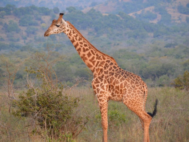
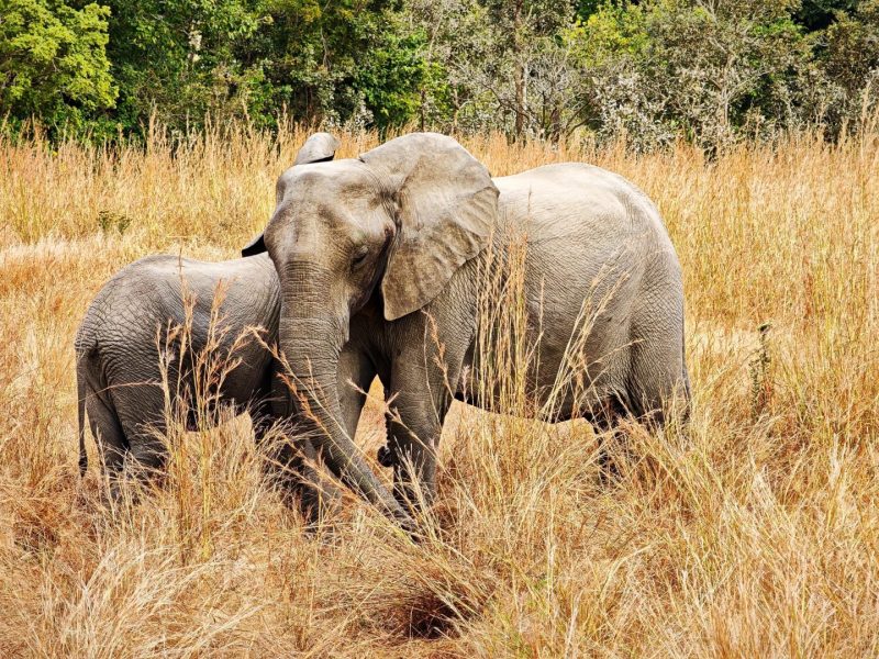
Elephant, buffalo, zebra, giraffe, eland, topi, impala, waterbuck, warthog, bushbuck, reedbuck and oribi are all recorded across the park, with roan and sable antelope in the wooded sectors. Sitatunga hold in the papyrus swamps along the lake inlets. Hippo and large Nile crocodile are abundant in the lakes and rivers.
Predators are present at recovering densities. Lion, leopard and spotted hyena occur, along with jackal and serval, and cheetah have been reported. Sightings are not guaranteed and any big cat here is a good day rather than an expectation.
The practical consequence for a visitor is that this park rewards patience and punishes a rushed itinerary. Concentrate on the water and the floodplain edges in the dry months, where whatever is present will be concentrated.
Habitat Differences Across the Merged Sectors
The three former reserves were not identical, and the differences persist.
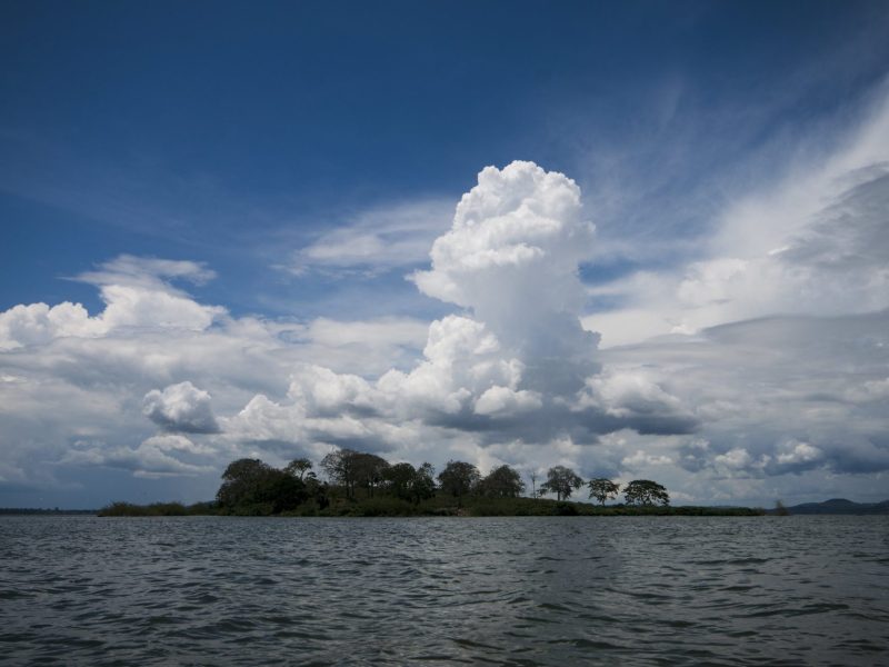
The Burigi sector, west: Dominated by Lake Burigi in its valley, roughly 30 kilometres long and 4 kilometres wide, with papyrus inlets and islands. Sitatunga habitat, the densest waterbird populations, and the park’s main boat safari activity.
The Biharamulo sector, south and east: Ridge and woodland country, with Brachystegia on the higher ground including Brachystegia boehmii toward the east. An airstrip here serves charter arrivals.
The Kimisi sector, north: Nearest the Rwandan border and the Kagera drainage, running toward the Kagera swamps. Part of the cross-border corridor toward Akagera.
The Chato addition, east: Ground sloping toward Lake Victoria on poorer soils, carrying large stands of Acacia xanthophloea fever trees. Closest to Chato town and the Katete Gate.
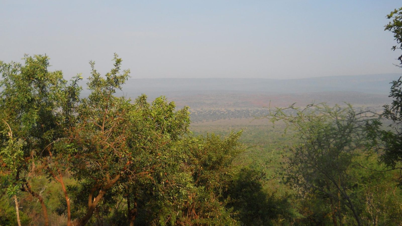
Across the whole area, the structure is a series of long north to south ridges separated by drainage lines flowing north. Protea and Combretum occupy the drier western ridges, open grassland covers much of the slopes, and surviving patches of Guinea-Congo forest hold on in the steeper gullies.
Why the Merger Mattered for Cross-Border Safari Corridors
The strongest ecological argument for combining the reserves was connectivity, and it works at two scales.
Internally, wildlife moves along the drainage lines between ridges rather than respecting reserve boundaries drawn on a map. Elephant movement between the Burigi area and the Moyowosi country further south has been documented. Managing three separate units meant three sets of rules and three sets of enforcement across ground animals crossed freely.
Externally, the area links into a wider transboundary system. Akagera National Park in Rwanda protects the far bank of the Kagera drainage. Ugandan rangeland lies to the north, and at a broader scale the corridor runs toward the Lake Mburo country. Ibanda-Kyerwa and Rumanyika-Karagwe National Parks, gazetted in the same round, cover the Tanzanian ground between.
For travellers this means a Rwanda and Tanzania overland routing has genuine logic. Akagera on one side, Burigi-Chato on the other, with the Rusumo Falls crossing on the Kagera between them.
Conservation Programmes and Community Tours Around the Park
TANAPA manages the park with the standard toolkit: ranger patrols, anti-poaching operations, habitat monitoring and community engagement in the surrounding districts.
Tourism revenue funds a share of this work, which is the honest reason your park fee matters somewhere this lightly visited. National conservation policy has emphasised strengthening anti-poaching operations, upgrading park roads and airstrips, and deepening relations with communities living around protected areas, since grassroots participation is what makes enforcement stick over time.
Conservation assessments of this area have made specific recommendations, including bringing a larger share of Lake Burigi and its lakeside swamps under protection and putting the lake fishery on a longer-term footing. Both matter for the wetland specialists, particularly sitatunga and any shoebill population that may be breeding in the papyrus.
Community and cultural visits to villages around the park and along the Lake Victoria shore can usually be arranged through operators working in the region.
Planning a Safari Across the Merged Sectors
One permit now covers the whole area, which sounds simpler than it is in practice.
The park is very large and the sectors are far apart. Driving from the Chato side to the Lake Burigi valley takes most of a day, and tracks tend to run along ridge crests or valley floors rather than crossing between drainage systems freely. A two-day visit realistically covers one sector properly, not three.
Decide what you came for. The lake and its swamps if you want boat safaris, sitatunga and birding. The Biharamulo ridge country if you want relief, viewpoints and walking. The Chato side if you are combining with Lake Victoria and want the shortest run in from the east.
TANAPA operates two multiple entry permits, a day-trip permit valid for twelve daylight hours and a sleep-over permit valid for twenty-four hours, both allowing re-entry within the window. Ask which you are being issued if you are basing outside the park.
Best Time for a Safari Across the Merged Park
June to September: The dry season and the best window across all sectors. Grass falls back, animals concentrate on permanent water, and tracks between sectors are at their most reliable.
October to December: Rains return, wildlife disperses, and birding improves as Eurasian migrants arrive. The woodland flushes with new leaf.
January to February: A drier interval between the peaks. Workable across most of the park and very quiet in visitor terms.
March to May: The heavier rainfall peak. Moving between sectors becomes genuinely difficult, ridge routes close first, and you should plan to stay in one area.
Frequently Asked Questions About the Merged Park
How much does it cost to visit the merged park?
One conservation fee covers the whole area. It currently runs at US$30 per person per day for non-East African adults aged sixteen and above and US$10 for children aged five to fifteen. Expatriates and Tanzanian residents pay US$15 and US$5, and East African Community citizens pay TZS 5,000 and TZS 2,000. Children under five are free. There is no seasonal variation in this park, and 18 percent VAT is added to all TANAPA charges. A park guide is US$20 per group per day.
When exactly was Burigi-Chato National Park created?
The three reserves were promoted for national park status in May 2018 alongside five other areas, and Burigi-Chato National Park was formally commissioned on 9 July 2019 at a ceremony presided over by President John Pombe Magufuli. The legal basis was the Wildlife Conservation Act of 2009, and management passed from the wildlife authority to Tanzania National Parks. The original reserves themselves date from the 1970s.
How big is the park, and why do sources disagree?
The figure now used by TANAPA and the Tanzania tourism authorities is 4,707 square kilometres, making it Tanzania’s fourth largest national park. Older literature on the game reserve complex gives around 4,702 square kilometres. Individual reserve areas vary more widely between sources, with Burigi given as anything from 2,200 to 2,941 square kilometres and Biharamulo from 731 to 1,300. Boundaries were adjusted over five decades and different surveys measured different things, so the discrepancies are expected rather than suspicious.
Why are wildlife numbers lower than in other Tanzanian parks?
Largely because of the mid-1990s refugee period. Several hundred thousand people arrived in this area after the Rwandan genocide, with the main camp on the edge of Burigi Game Reserve, and wild meat hunting rose steeply. Reported declines in large mammal populations run to around sixty percent between 1994 and 1996, with district reports putting depletion in Burigi and Kimisi at roughly two thirds. Recovery has been under way since the late 1990s and accelerated with national park status, but this is a population rebuilding from an unusually low base.
Can I visit all three former reserve areas in one trip?
Not properly in a short visit. The park runs 4,707 square kilometres and the sectors are far apart, with tracks following ridge crests or valley floors rather than crossing freely between drainage systems. Driving from the Chato side to the Lake Burigi valley takes most of a day. Two days covers one sector well. Four days lets you take in two. Anything less and you will spend the trip in the vehicle.
What happened to Rumanyika Game Reserve?
It became Rumanyika-Karagwe National Park in the same round of upgrades. It was a smaller reserve of around 245 square kilometres in the same complex, north of the Burigi and Kimisi ground, and it now sits in the same TANAPA fee band as Burigi-Chato. Ibanda-Kyerwa National Park was gazetted at the same time. All three sit along the Kagera corridor toward the Rwandan and Ugandan borders and can be combined on one trip.
Is hunting still permitted anywhere in the merged area?
No. Game reserve status in Tanzania permits regulated hunting; national park status does not. That change took effect with the 2019 gazettement across the whole merged area. Sport fishing is permitted inside the park under specific guidelines, restricted to between seven in the morning and five in the afternoon and charged at US$25 per adult per day, but hunting has ended.
Booking Your Burigi-Chato Trip
The safari companies and tour operators listed on this website put trips like this together for a living and know which camps, guides and routes actually deliver. We are an independent guide to Burigi-Chato; we do not book or sell tours ourselves.
When you are ready, arrange your safari, tour or holiday with one of the recognised operators listed here. Tell them your dates and what matters most, and a real person, not a form, will handle the itinerary, park bookings and logistics for you.