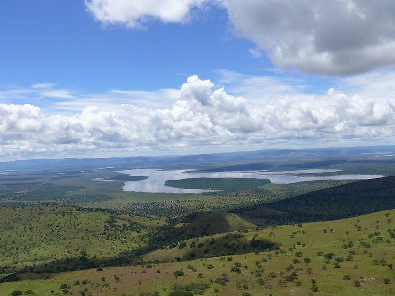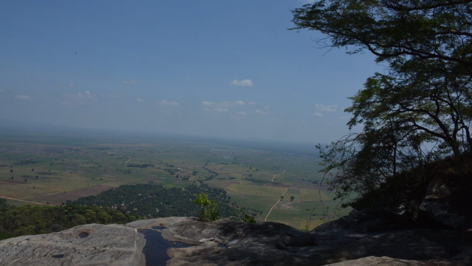
The best scenic viewpoints in Burigi-Chato National Park are on the valley walls above Lake Burigi, along the rocky crags of the escarpment edges, and on the ridge crests looking east toward Lake Victoria or west across the Kagera drainage. Sundowners are permitted in designated areas for a small per-person fee. Burigi-Chato covers 4,707 square kilometres of northwestern Tanzania, and its ridge structure gives it elevated views that flatter parks cannot offer.
None of these viewpoints are signposted. You find them by asking a guide, not by driving around.
Why This Park Has Viewpoints at All on a Burigi-Chato Safari
Most East African savannah is flat, and a Burigi-Chato safari is different because the ground here does not stay level for long.
The park is built on a series of parallel ridges running roughly north to south, separated by drainage lines with rivers flowing north between them. Lake Burigi occupies one of those valleys, which is why it is long and narrow rather than round. Where slopes have been too steep for soil to hold, rock is exposed along the escarpment edges as crags.
East of the ridges the ground falls toward Lake Victoria. West of them lie the Kagera swamps and the Rwandan border. Between the two, a single day’s drive can take you from a floodplain at the bottom of a valley to a stony crest with fifty kilometres of view.
That relief is the whole basis for the scenery here, and it is the park’s clearest advantage over its flatter neighbours.
Run your viewpoint drives in the middle of the day, when the woodland below has gone quiet for wildlife anyway. Ridge driving in the heat is unproductive for close sightings but excellent for reading the park and working out where to be at dusk.
The Valley Walls Above Lake Burigi: The Best View on Safari
This is the best view in the park and the one worth planning around.
Lake Burigi runs roughly 30 kilometres long and about 4 kilometres wide along its valley floor, with a scatter of islands and a great many inlets and bays branching off the main body. From the slopes above it you take in the whole shape at once: the water threading along the valley, the papyrus at the swampy edges, the tree line following the shore and the occasional palms standing along the valley lines.
Morning gives you the clearest air, particularly after rain, when the view runs a long way in both directions. Evening gives you the light on the water.
The western-facing spots are the ones to ask about by name for sundowners, since the sun drops behind the ridges beyond the lake. Light fades fast this close to the equator, so be in position well before you want to be.
Escarpment Crags and Rocky Outcrop Viewpoint Tours
The crags along the escarpment edges give a different kind of view: closer, more vertical, with rock in the frame.
These are exposed faces and boulder fields where the gradient has stripped the soil. Standing on one puts you above the woodland canopy with the valley floor below, and the rock itself gives foreground that a grass ridge cannot.
Wildlife adds to the reason for being there. Klipspringer stand on the rock edges and freeze rather than running. Rock hyrax colonise the boulder piles and sun themselves on exposed faces through the morning. Raptors work the thermals rising off warmed rock, so the mid-morning hours give you soaring birds against a ridge line rather than blank sky.
Getting onto them often means walking the last stretch. TANAPA offers guided walks with an armed ranger, split into short walks of one to four hours and long walks above four hours, and the crags are where walking pays off most.
Ridge Crest Viewpoint Tours East Toward Lake Victoria
Looking east from the higher ground, the country falls away toward the largest lake in Africa.
The soils on this side are poorer, and they carry large stands of Acacia xanthophloea, the yellow-barked fever trees that mark low-lying wet ground. From above, those stands read as a distinct band of colour and texture across the slope, separating the wooded ridges from the lake basin.
The park boundary reaches Lake Victoria around Bunkwe Bay, and Chato town sits on the shore about 40 kilometres from the Katete Gate. On a clear morning the lake basin opens out ahead of you.
This is the accessible side for anyone entering from Mwanza or Geita, which makes these viewpoints the practical choice on a short visit that does not reach the western sector.
Western Ridge Viewpoints Across the Kagera Drainage
From the western ridges the view runs toward the Kagera swamps and the Rwandan border.
The vegetation up here is distinct. Protea and Combretum dominate the drier western ridges, which surprises visitors who associate Protea with the Cape but which is normal on poor, well-drained upland soil across a much wider range. Higher ground elsewhere carries Brachystegia woodland, including Brachystegia spiciformis, somewhat stunted here at the northern edge of its range.
Beyond the swamps lies Akagera National Park in Rwanda, protecting the opposite bank of the same drainage. You are looking at a transboundary system from one of the few places you can take it in visually.
This is the remote side of the park and the least visited. Reaching it means either a long internal drive or a charter into the airstrip near the Nkonje ranger post.
Standing on a western ridge you can see two countries and the headwaters of the Nile drainage in one sweep. Very few viewpoints in Tanzania offer that.
Floodplain Overlooks for Wildlife Watching and Scenery Together
The best viewpoints are not always the highest ones, and the floodplain overlooks are where scenery and wildlife meet.
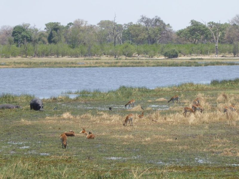
Where a track runs along the edge of a valley above a floodplain, you get an open view across grassland to a tree line, with animals visible at a distance that would be impossible from inside the woodland. In the dry season, when the floodwater has retreated and the grass is grazed down, buffalo, zebra, topi, impala and waterbuck concentrate on this ground.
Mist sitting on the floodplain at dawn, with the tree line behind and animals moving out of cover, is the image most photographers come away with.
These overlooks are also the practical place to spend last light, since predators work the same edges and the light is best there anyway.
Sundowner Spots and How They Work on a Park Safari
Sundowners are permitted in designated areas across Tanzanian national parks for a small per-person fee, and this is the mechanism by which you legitimately stop, get out of the vehicle and stand somewhere with a view at the end of the day.
Ask your guide for the designated spots by name rather than assuming any pleasant ridge will do. Getting out of a vehicle in a national park is regulated, and the designated areas exist because they have been assessed.
Bush meals are also charged nominally in designated areas, which lets you build a scenic picnic into a day rather than eating in the vehicle.
Park driving hours run from six in the morning to six in the evening, so a sundowner needs planning against that rather than being an open-ended evening.
Viewpoints on Foot: Guided Walking Safaris to the High Ground
Some of the best ground here has no vehicle track, and walking is the way to reach it.
Walking safaris are conducted with an armed ranger and split into short walks of one to four hours and long walks above four hours. On the ridges the ground is open enough to see, the gradients give you something to work at, and the crags reward close inspection.
Take the long walk option if you are fit for it, since four hours gets you onto a ridge properly rather than circling near the vehicle. Closed boots with ankle support, long trousers and more water than you think you need. Stony slopes in equatorial sun are harder work than the distance suggests.
Night nature walks are also offered in applicable parks, which gives a completely different experience of the same ground.
When to Visit the Viewpoints Through the Safari Year
June to September: Clearest early mornings and the longest views of the year. Stony ridge tracks are firm and every viewpoint is reachable. Dust builds through the afternoon and gives good backlit atmosphere.
October to December: Hazier views, but storm light after downpours is the best of the year and the woodland flushes into new leaf in coppers and reds.
January to February: A drier interval with usable gradients and very few visitors. Grass is high on the slopes but the ridge tracks hold up.
March to May: The heavier rains, and the season when the viewpoints go out of reach. Steep stony gradients turn slippery and escarpment routes are the first to close.
Getting to the Viewpoints for Your Safari
Access shapes which viewpoints you will actually see, so decide before you book.
Entering through the Katete Gate, about 40 kilometres from Chato town, puts you on the eastern side with the views toward Lake Victoria. Reaching the Lake Burigi valley walls in the western sector from there takes most of a day, since tracks follow ridge crests or valley floors rather than crossing freely between drainage systems.
A charter into the airstrip near the Nkonje ranger post beside Lake Burigi drops you at the best viewpoints directly. The Biharamulo airstrip serves the southern ground.
By road, Mwanza is around 150 kilometres out on a three to five hour drive, Bukoba is two to three hours, and a high-clearance 4×4 with low range is necessary rather than advisable on the ridge routes.
Frequently Asked Questions About Viewpoints on a Burigi-Chato Safari
Do I have to pay extra to stop at a viewpoint?
Not to stop and look from your vehicle. Sundowners in designated areas, where you get out and stand with a drink, are currently charged at US$5 per adult and US$2 per child aged five to fifteen, with TZS 5,000 and TZS 2,000 for East African Community citizens. Bush meals in designated areas are US$5 per person. Both sit on top of the daily conservation fee of US$30 per non-East African adult, and 18 percent VAT applies to all TANAPA charges.
Which is the single best viewpoint in the park?
The valley walls above Lake Burigi, looking down a lake running roughly 30 kilometres long and about 4 kilometres wide with its islands, papyrus inlets and shoreline tree line. The western-facing spots there work best for evening light. It sits in the western sector, so reaching it means either a long internal drive from the eastern gates or a charter into the airstrip near the Nkonje ranger post.
Are the viewpoints signposted?
No. The park was only gazetted in 2019 and visitor infrastructure remains minimal, with no marked viewpoint network. Tracks are unsignposted in places throughout the park. This is one of the clearest arguments for taking a park guide, which is charged at US$20 per group per day rather than per person and makes the difference between finding the good ground and driving past it.
Can I get out of the vehicle at a viewpoint?
Only in designated areas, and ideally with a guide present. Getting out of a vehicle in a Tanzanian national park is regulated, and the designated sundowner and bush meal spots exist because they have been assessed for safety. Elsewhere, stay in the vehicle. If you want to be on foot on the high ground, book a walking safari with an armed ranger, at US$20 per adult for short walks and US$25 for long ones.
How high is the ridge country?
This is ridge and escarpment terrain rather than mountain country. The relief comes from a series of long north to south ridges separated by drainage lines, with rocky crags exposed along the steeper escarpment edges and valleys cut between them. You get genuine gradients, elevated viewpoints and long sightlines, not peaks. Nobody comes here to climb, and there is no summit trail.
What will I see from the western ridges?
The Kagera swamps and the ground running toward the Rwandan border, with Akagera National Park protecting the opposite bank of the same drainage beyond. The vegetation up here is distinctive, with Protea and Combretum on the drier western ridges. This is the remote side of the park and the least visited, so reaching it takes either a long internal drive or a charter flight to the Nkonje airstrip.
Can I reach the viewpoints in the rainy season?
Often not, during the heavier March to May peak. Steep stony gradients become slippery when wet and the escarpment routes are usually the first to close, which costs you exactly the ground that makes this park scenic. If you are travelling in those months, plan around the lake and the lower tracks, and treat the ridges as a bonus if conditions allow. The lighter November and December rains are less disruptive.
Booking Your Burigi-Chato Trip
The safari companies and tour operators listed on this website put trips like this together for a living and know which camps, guides and routes actually deliver. We are an independent guide to Burigi-Chato; we do not book or sell tours ourselves.
When you are ready, arrange your safari, tour or holiday with one of the recognised operators listed here. Tell them your dates and what matters most, and a real person, not a form, will handle the itinerary, park bookings and logistics for you.