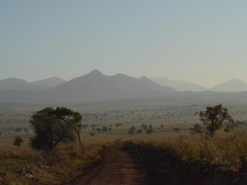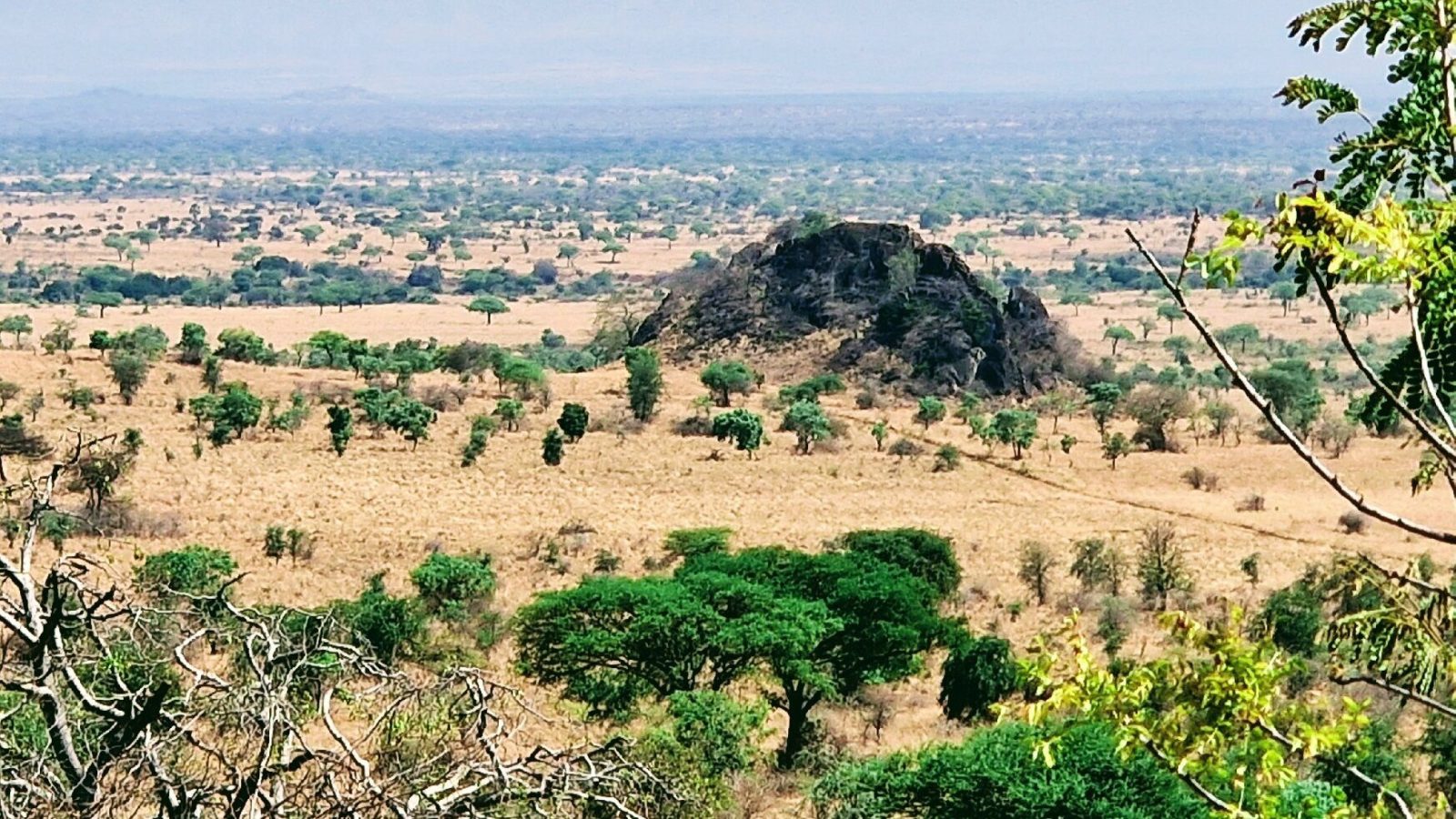
The rolling hills, escarpments and rocky crags of Burigi-Chato National Park run as a series of long north to south ridges separated by drainage lines, giving the park its elevated viewpoints, its steep-sided valleys and its best scenery. Game drives here follow the ridge tops and the slopes between them, and short guided walks reach the crags. Burigi-Chato covers 4,707 square kilometres of northwestern Tanzania, and this ridge structure is what sets it apart from the flat parks further east.
You feel it as soon as you enter. The ground keeps rising and falling.
Ridge Country on a Burigi-Chato Safari
Anyone arriving on a Burigi-Chato safari expecting Serengeti flatness gets a surprise. The park sits on a series of parallel ridges running roughly north to south, with rivers and drainage lines flowing north between them. Lake Burigi itself lies in one of those drainage lines, which is why it is long and narrow rather than round.
East of the ridges the ground slopes away toward Lake Victoria. West of them lie the Kagera swamps along the Rwandan border. Between the two, the country pitches up and down repeatedly, and a single day’s drive can take you from a floodplain at the bottom of a valley to a stony ridge crest with fifty kilometres of view.
That relief does real work. It creates rain shadow, it separates habitats, and it gives the park a set of natural viewpoints that flat reserves simply do not have.
Escarpment Game Drive Safaris Along the Rocky Crags
The escarpment game drive is the signature terrain experience here. Rocky crags run along the escarpment edges, exposed where the slope has been too steep for soil to hold, and the tracks that follow these lines give you the park from above rather than from within it.
Driving a ridge is slow. Surfaces are stony, gradients are real, and a 4×4 in low range is not optional in places. What you gain is sightlines. From an escarpment track you look down into valleys where the woodland thins and can pick up movement at a distance that would be impossible from inside the trees.
Ask your guide to run one escarpment route in the middle of the day, when the woodland below has gone quiet anyway. Ridge driving in the heat is unproductive for close sightings but excellent for reading the park and working out where to be at dusk.
Tyre pressure matters on stony ground. Carry two spares if you are self-driving, and keep to authorised tracks, which is a park rule and sensible practice besides.
Scenic Viewpoint Tours Above Lake Burigi
The best elevated views in the park look down the length of Lake Burigi, which runs roughly 30 kilometres long and about 4 kilometres wide along its valley floor. From the valley walls above it you get the whole shape of the water at once: the islands, the inlets running off it, the papyrus at the swampy edges, the tree line following the shore.
Sundowners are permitted in designated areas of Tanzanian national parks for a small per-person fee, and the western-facing viewpoints above the lake are the obvious places to ask about. Light drops fast this close to the equator, so plan to be in position well before you want to be.
Elsewhere in the park the ridges give views east toward the Lake Victoria basin and west across the Kagera drainage. On a clear morning after rain you can see a very long way in both directions.
Wildlife Watching on the Hills and Rocky Outcrops
Rocky ground supports a different set of animals from the woodland below it, and this is one of the more interesting things about a park with genuine relief.
Klipspringer are the classic rock-dwelling antelope of East African crags, standing on tiptoe on the rock edges and freezing rather than running. Rock hyrax colonise boulder piles and sun themselves on exposed faces in the morning. Both are easier to find on the crags than anywhere else in the park.
Leopard use rocky ground for cover and for lying up during the day, and the crags along the escarpments are the habitat most likely to hold them, though sightings anywhere in Burigi-Chato are not guaranteed and should be treated as a good day. Baboon troops work the rock faces and the woodland below.
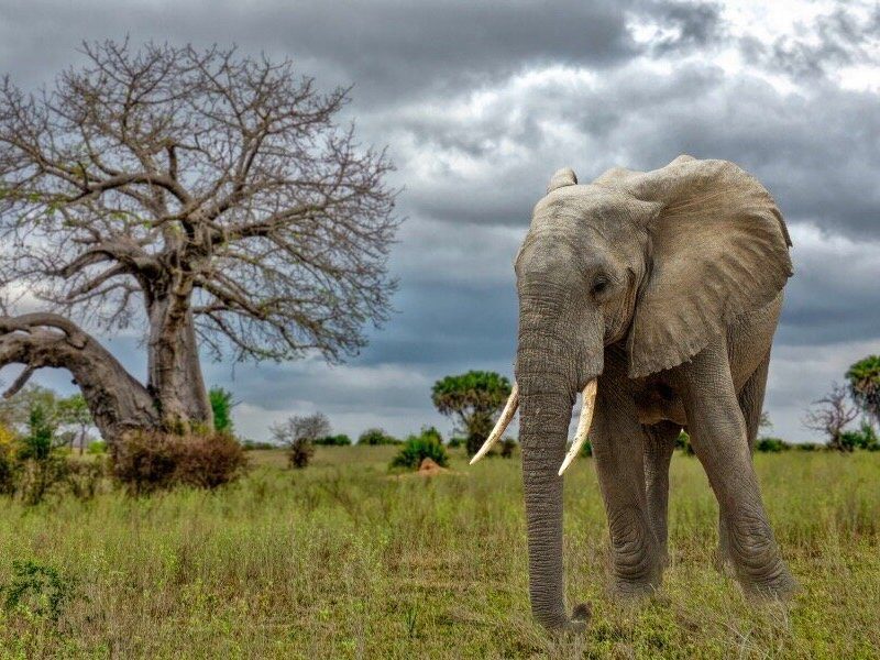
On the open grassland stretches along the slopes you find the grazers: zebra, topi, impala, eland, and the miombo specialists roan and sable antelope where the woodland thickens. Buffalo herds move through the valleys. Elephant use the drainage lines between ridges.
Raptor and Cliff Birdwatching Safaris on the Escarpments
Escarpments are raptor country, and a birdwatching safari that includes the crags picks up species you will miss entirely on the lake.
Cliff faces and rocky outcrops give nesting and perching sites, and the thermals rising off warmed rock through the morning give soaring birds their lift. Augur buzzard, black-chested snake eagle and various vultures work these updrafts. Verreaux’s eagle is associated with rocky crag country across the region wherever hyrax are present, which makes the Burigi-Chato outcrops worth scanning.
Down at lake level the picture changes completely, with African fish eagles at unusually high density along the shoreline and a full waterbird community in the swamps. Working both in one day gives a far longer list than either alone.
Rock-associated smaller birds include cliff chat, mocking cliff chat and rock martin. Scan the exposed faces mid-morning once the sun has been on them for an hour or two.
The ridges are the reason this park photographs better than its wildlife numbers alone would suggest. Depth, layering and a real horizon are things flat country cannot give you.
Guided Walking Safaris and Hiking on the Ridges
TANAPA offers walking safaris in Burigi-Chato with an armed ranger, split into short walks of one to four hours and long walks above four hours. The ridges are where walking makes most sense, because the ground is open enough to see, the gradients give you something to work at, and the crags reward close inspection.
On foot you notice the geology. Exposed rock faces, boulder fields, the way soil depth changes as you climb and the vegetation changes with it. You also notice hyrax middens, klipspringer droppings on rock ledges, and raptor pellets under perching sites, none of which register from a vehicle.
Take the long walk option if you are fit for it. Four hours gets you onto a ridge properly rather than circling near the vehicle.
Closed boots with ankle support, long trousers, and more water than you think you need. Stony slopes in equatorial sun are harder work than the distance suggests.
Vegetation of the Ridges: Protea, Combretum and Open Grassland
The ridge vegetation is genuinely distinct from the valley floors, and knowing what you are looking at makes the terrain readable.
On the drier western ridges, Protea and Combretum dominate. Protea in an African savannah setting surprises visitors who associate the genus with the Cape, but it occurs on poor, well-drained upland soils across a much wider range than that. Higher ground elsewhere in the park carries Brachystegia woodland, including Brachystegia spiciformis, which is somewhat stunted here at the northern edge of its range, and Brachystegia boehmii toward the east.
On the slopes between ridge and valley there are considerable stretches of open grassland, and these are the productive grazing areas. Down in the steeper valleys and gullies you find surviving patches of Guinea-Congo forest, and relict sclerophyll forest survives in sheltered pockets.
East of the ridges, where the ground falls toward Lake Victoria and the soils are poorer, large stands of Acacia xanthophloea take over. These are the fever trees, yellow-barked and unmistakable.
Photography Safaris in the Burigi-Chato Hill Country
Relief solves the biggest problem in savannah photography, which is that flat country gives you no way to build depth into a frame.
Ridge lines receding into haze give you layers. Escarpment edges give foreground. Shooting from an elevated track down onto a valley floor lets you place animals in context rather than filling the frame with a single subject against nothing. Early and late light rakes across the ridges and picks out the rock faces.
The technical challenge is dynamic range. A sunlit ridge crest and a shaded valley floor in the same frame will exceed what a single exposure holds, so bracket or expose for the highlights and lift the shadows afterwards.
Drones are prohibited in all Tanzanian national parks. Commercial filming requires a permit arranged in advance through TANAPA.
How the Ridges Set Game Drive Routes and Park Access
Terrain dictates where you can drive, and in Burigi-Chato it dictates more than usual.
Tracks tend to run either along ridge crests or along valley floors, with fewer routes crossing between them. That means a day’s driving often commits you to one drainage system, and moving to another can take longer than the map distance suggests. Ask your guide to plan around this rather than assuming you can hop between sectors freely.
Wet season access is the real constraint. Steep stony gradients become slippery, valley crossings flood, and unsurfaced tracks in the park can become impassable. During the heavier March to April rainfall peak, some routes close entirely.
Driving hours across Tanzanian national parks run from six in the morning to six in the evening, with a 50 kilometre per hour speed limit. On this terrain you will rarely get near that anyway.
Best Time for a Hill and Escarpment Safari in Burigi-Chato
Two rainfall peaks govern the year here, one around November and December and a second in March and April, with settled dry weather from June through September.
June to September: The best window. Grass falls back on the slopes, sightlines from the ridges open right up, stony tracks are firm, and the air is often clearest in the early morning. Cool nights at elevation.
October to December: Rains return and the ridges green up fast. Views are hazier, but the light after a storm is exceptional and the woodland flushes with new leaf.
January to February: A drier interval. Gradients are usable, the park is very quiet, and grass is high but not yet at its worst.
March to May: Heaviest rain. Steep tracks become the limiting factor, and ridge routes are the first to close. Not the season for this part of the park.
Getting to the Hill Country for Your Safari
Mwanza is the main gateway, roughly 150 kilometres away with a drive of three to five hours depending on route and season. Bukoba is closer at around two to three hours. Chato town sits about 40 kilometres from the Katete Gate on the eastern side.
Chato and Bukoba both receive domestic flights. Private charters can land at an airstrip near the Nkonje ranger post beside Lake Burigi, or at the Biharamulo airstrip, either of which leaves you within reach of the western ridges without a long drive in.
A high-clearance 4×4 is necessary rather than advisable on this terrain. Fuel up in Chato, Biharamulo or Bukoba, as there is none inside the park.
Frequently Asked Questions About a Burigi-Chato Hills Safari
How much does it cost to visit Burigi-Chato?
The conservation fee currently runs at US$30 per person per day for non-East African adults aged sixteen and above and US$10 for children aged five to fifteen. Expatriates and Tanzanian residents pay US$15 and US$5, and East African Community citizens pay TZS 5,000 and TZS 2,000. Under-fives are free. There is no peak and low season split in this park, and all TANAPA charges carry 18 percent VAT on top.
What do walking safaris on the ridges cost?
Short walks of one to four hours are currently US$20 per adult and US$10 for children aged twelve and over. Long walks above four hours run at US$25 and US$15. Night nature walks are US$10 per adult. A park guide is charged at US$20 per group per day rather than per person, which makes it cheap across a family or a group of four. Sundowners in designated areas are US$5 per adult and US$2 per child.
What vehicle do I need for the escarpment tracks?
A high-clearance 4×4 with low range. The ridge and escarpment routes are stony with real gradients, and a two-wheel drive vehicle will not manage them in any season. Vehicle entry is charged daily by tare weight, currently TZS 20,000 for a Tanzanian or non-commercial East African registered vehicle up to 2,000 kilograms, rising to TZS 35,000 and TZS 60,000 for heavier bands. Commercial East African and foreign-registered vehicles pay US$40, US$150 and US$200 across those bands, and open vehicles carry a fifty percent surcharge.
How high are the hills in Burigi-Chato?
This is ridge and escarpment country rather than mountain country. The relief comes from a series of long north to south ridges separated by drainage lines, with rocky crags exposed along the steeper escarpment edges and valleys cut between them. You are looking at rolling terrain with genuine gradients and good elevated viewpoints, not peaks. Nobody comes here to climb.
Can I see leopard on the rocky outcrops?
Possibly, and the crags are the habitat most likely to hold them, but no sighting here is guaranteed. Burigi-Chato’s predator numbers are recovering from heavy poaching pressure during its years as a game reserve, and densities remain well below the famous parks. Treat a leopard as a very good day rather than an expectation. Klipspringer and rock hyrax on the outcrops are far more reliable.
Where are the best viewpoints in the park?
The valley walls above Lake Burigi give the strongest views, looking down the length of a lake that runs about 30 kilometres long and 4 kilometres wide. Ridge crests further east give views out over the ground falling away toward Lake Victoria, and the western ridges look across toward the Kagera drainage. Ask your guide by name for the designated sundowner spots, since those are chosen for exactly this.
Is the ridge country accessible in the rainy season?
Less so than the rest of the park. Steep stony gradients become slippery when wet, valley crossings flood, and escarpment routes are usually the first to close during the March to April rainfall peak. If you are travelling in the wet months, plan around the lake and the lower tracks and treat the ridges as a bonus if conditions allow.
Booking Your Burigi-Chato Trip
The safari companies and tour operators listed on this website put trips like this together for a living and know which camps, guides and routes actually deliver. We are an independent guide to Burigi-Chato; we do not book or sell tours ourselves.
When you are ready, arrange your safari, tour or holiday with one of the recognised operators listed here. Tell them your dates and what matters most, and a real person, not a form, will handle the itinerary, park bookings and logistics for you.