Burigi-Chato National Park is located in northwestern Tanzania, spanning the Kagera and Geita regions, with its eastern edge on Lake Victoria and its western boundary running along the Kagera River near the Rwandan border. Visitors reach it from Mwanza, Bukoba or Chato, all of which sit on the lake. The park covers 4,707 square kilometres, centred near 2°18′ south and 31°10′ east, making it Tanzania’s fourth largest national park.
Its position is the whole story here. This park exists where it does because of what surrounds it.
Where the Park Sits on the Tanzania Safari Map
Think of Tanzania’s northwest corner, the wedge of country between Lake Victoria and the Rwandan and Burundian borders. That is where a Burigi-Chato safari takes place.
The park runs roughly east to west across that wedge. At the eastern end the ground falls away toward Lake Victoria and the boundary reaches the water around Bunkwe Bay. At the western end sit the Kagera swamps and the river that marks Tanzania’s border with Rwanda. Between them lie ridges, valleys, lakes and several thousand square kilometres of wooded savannah.
This puts it a long way from the parks most visitors have heard of. Arusha, the gateway for the northern circuit, is on the far side of the country. Dar es Salaam is over a thousand kilometres away by road.
If you are orienting yourself on a map, find Lake Victoria first, then follow the Tanzanian shore west from Mwanza toward Bukoba. The park fills the inland ground behind that stretch of coast.
Regions and Districts the Safari Area Covers
Administratively the park spreads across two regions and five districts, which is unusual and reflects its origin as three separate game reserves.
In Kagera Region it occupies parts of Karagwe, Biharamulo, Muleba and Ngara districts. In Geita Region it covers ground in Chato district, which gives the park the second half of its name. Biharamulo is usually cited as the nearest town of any size.
The former reserves each had their own district footprint. Burigi Game Reserve reached across Biharamulo, Karagwe, Muleba and Ngara. Biharamulo Game Reserve covered Biharamulo and Muleba. Kimisi Game Reserve sat in Karagwe and Ngara. Those old boundaries no longer matter for a permit, but they explain why the park’s shape is so irregular.
Kagera Region takes its name from the river. So does the wider basin.
Coordinates and Boundaries of the Burigi-Chato Safari Area
The park is centred at approximately 2°18’33” south, 31°10’16” east, which places it just over two degrees below the equator. Elevation across the area is high enough to keep temperatures moderate, with warm days and cool nights year round rather than the heat of the low-lying interior.
Total area is 4,707 square kilometres. Only Nyerere, Ruaha and Serengeti are larger among Tanzania’s national parks, and the ordering of that list is worth checking against whichever source you are reading, since several put Burigi-Chato third and others fourth depending on how Nyerere is counted.
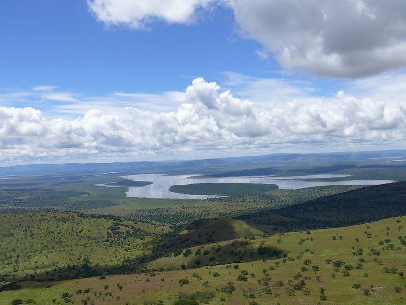
The boundaries are defined by water at both ends. Lake Victoria in the east. The Kagera River and its swamps in the west. In between, the internal structure is a series of long north to south ridges separated by drainage lines flowing north, with Lake Burigi occupying one of those valleys.
Which Circuit Burigi-Chato Belongs To for Tours
Tanzania’s tourism authorities place Burigi-Chato in the Western Circuit, alongside Rubondo Island, Ibanda-Kyerwa and Lake Victoria itself. You will also see the area described as the Lake Zone, which is the more commonly used local term.
That classification matters practically because it tells you what the park pairs with. Western Circuit trips are built around Lake Victoria, the island parks, the Kagera corridor and, further south, Katavi, Mahale and Gombe. They are not built around Arusha.
The circuit is young. Burigi-Chato, Ibanda-Kyerwa and Rumanyika-Karagwe were all gazetted in the same round in 2019, opening what amounts to a new tourism corridor across northwestern Tanzania. Infrastructure is still catching up with the designation.
Nearest Towns and Cities for Your Safari Base
Nobody stays inside this park in comfort, so the towns around it matter more than usual.
Chato: On the Lake Victoria shore in Geita Region, roughly 40 kilometres from the Katete Gate. The closest town, with an airport receiving domestic services and basic guesthouses.
Biharamulo: Inland to the south, usually listed as the park’s nearest town. Has an airstrip and modest accommodation, and sits close to the southern sector.
Bukoba: North on the western lake shore in Kagera Region, two to three hours from the park. The largest town in the immediate area, with scheduled flights, a lake ferry connection and a wider choice of hotels.
Kayanga: West toward Karagwe, useful if you are heading for the Rumanyika-Karagwe side. En-suite guesthouse accommodation exists here.
Mwanza: The largest city on the Tanzanian lake shore, roughly 150 kilometres away. The main regional airport and the natural hub for a wider Lake Zone trip.
Fuel, cash, groceries and reliable mobile signal are all in these towns and none of them are inside the park.
Park Gates and Where You Enter for a Game Drive Safari
The Katete Gate on the eastern side is the entry point most visitors use, sitting about 40 kilometres from Chato town. It is the natural way in for anyone arriving from Mwanza, Geita or the Lake Victoria shore.
Inside the park, the Nkonje ranger post beside Lake Burigi is the main operational base in the western sector, with an airstrip alongside it and basic accommodation. The Biharamulo airstrip serves the southern ground.
Because the park is large and the sectors are far apart, which gate you use decides which part of the park you will see. Driving from the Chato side to the Lake Burigi valley takes most of a day, so plan your entry point around what you actually came for rather than around what is closest to your last stop.
Where you enter this park matters more than at almost any other Tanzanian reserve. Four thousand seven hundred square kilometres with limited crossing tracks means the gate is a commitment, not a formality.
Neighbouring Parks and Reserves on the Same Safari Circuit
Burigi-Chato does not sit alone. It is one piece of a chain of protected areas across the northwest.
Rubondo Island National Park lies out in the southwest corner of Lake Victoria, around 240 square kilometres, the largest island national park in Africa and home to a chimpanzee habituation programme. Ibanda-Kyerwa and Rumanyika-Karagwe National Parks sit north along the Kagera corridor toward the Ugandan and Rwandan borders, both gazetted in the same round as Burigi-Chato. Saanane Island National Park, Tanzania’s smallest, sits in the lake off Mwanza.
South of the park, the Moyowosi and Kigosi country extends across a vast wetland system, and elephant movement between the Burigi area and Moyowosi has been documented along connecting routes.
Across the border in Rwanda, Akagera National Park protects the far bank of the Kagera drainage, which makes it the park’s closest ecological neighbour, national borders notwithstanding.
How Close the Park Is to Rwanda, Uganda and Burundi
Very close, and this is one of the more interesting things about its position.
The western boundary follows the Kagera River, which forms much of Tanzania’s border with Rwanda along its middle course. Rusumo Falls, the main crossing point between the two countries, sits on that river. From the Rwandan side, Kigali is roughly a half day’s drive away.
Uganda is not far north. The Kagera turns east and forms part of the Tanzania and Uganda border before emptying into Lake Victoria, and the wider corridor extends toward Ugandan rangeland and the Lake Mburo country. Burundi lies to the southwest, upstream on the same river system.
For a traveller this means a Rwanda and Tanzania overland routing has genuine logic. Akagera on one bank, Burigi-Chato on the other. Note that the East Africa Tourist Visa covers Rwanda, Uganda and Kenya but not Tanzania, which needs its own.
Where the Park Sits Relative to Serengeti and the Northern Circuit
Around 200 kilometres separate Burigi-Chato from the western corridor of Serengeti National Park, with Mwanza sitting between them as the practical hub. The Ndabaka Gate into western Serengeti is roughly 145 kilometres from Mwanza on a three to four hour drive.
That proximity opens a routing most visitors never consider: fly into Mwanza rather than Arusha, run the western Serengeti, then continue into the Lake Zone parks. It works especially well when the wildebeest migration is in the western corridor.
Arusha, Ngorongoro, Tarangire, Lake Manyara and Kilimanjaro are all on the far eastern side of the country and belong to a different trip entirely. Combining Burigi-Chato with the classic northern circuit means an internal flight rather than a drive.
Why the Location Produces the Habitats You See on Safari
Position explains vegetation here more directly than in most parks.
Sitting beside Lake Victoria means strong local convection and more reliable rainfall than the latitude alone would suggest, delivered in two peaks, around November and December and again in March and April, with dry weather from June through September. That reliability supports permanent lakes, papyrus swamps and floodplains that fill on schedule.
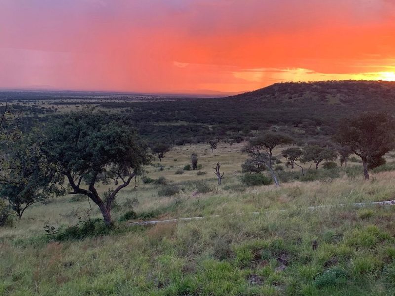
The ridge structure creates the rest. Higher ground carries wooded savannah, with Brachystegia on the uplands and Protea and Combretum on the drier western ridges. Slopes carry open grassland. Steep gullies shelter surviving patches of Guinea-Congo forest. East of the ridges, where soils are poorer near the lake, large stands of Acacia xanthophloea fever trees take over.
Sitting at the meeting point of these zones is why the species list runs from sitatunga in the papyrus to sable antelope in the miombo.
Getting to the Location for Your Safari
From Mwanza the drive runs around 150 kilometres and takes three to five hours depending on route and season. Bukoba is nearer at two to three hours. Chato town is about 40 kilometres from the Katete Gate.
By air, Chato and Bukoba both receive domestic flights, with a road transfer at the far end. Private charters can land at the airstrip near the Nkonje ranger post beside Lake Burigi, or at the Biharamulo airstrip. Mwanza has the largest airport in the region, connecting to Dar es Salaam, Arusha, Kigali and the Serengeti airstrips.
Lake ferries operate between Mwanza, Bukoba and the island ports, which is the slow and scenic option if you have the days for it.
A 4×4 is sensible year round and necessary in the wet months. Fuel before you turn inland.
Frequently Asked Questions About the Park’s Location
What are the exact coordinates of Burigi-Chato National Park?
The park is centred at approximately 2°18’33” south, 31°10’16” east, a little over two degrees below the equator. It spans 4,707 square kilometres across the Kagera and Geita regions of northwestern Tanzania, running from the Lake Victoria shore in the east to the Kagera River on the Rwandan border in the west.
What does it cost to enter the park once you get there?
The conservation fee currently runs at US$30 per person per day for non-East African adults aged sixteen and above and US$10 for children aged five to fifteen. Expatriates and Tanzanian residents pay US$15 and US$5, and East African Community citizens pay TZS 5,000 and TZS 2,000. Children under five are free. There is no seasonal variation in this park, and 18 percent VAT is added to all TANAPA charges. Vehicle entry is charged separately by weight, starting at TZS 20,000 per day for a Tanzanian registered vehicle up to 2,000 kilograms.
Which region is Burigi-Chato in?
Two regions. The bulk of the park sits in Kagera Region, across the Karagwe, Biharamulo, Muleba and Ngara districts, with the eastern portion in Chato district of Geita Region. This split reflects its origins as three separate game reserves that were merged into one national park in 2019. Biharamulo is usually cited as the nearest town of any size.
Is Burigi-Chato in the northern or western circuit?
Western Circuit, in the classification used by Tanzania’s tourism authorities, though the area is more commonly called the Lake Zone locally. It groups with Rubondo Island, Ibanda-Kyerwa, Rumanyika-Karagwe and Lake Victoria rather than with Serengeti, Ngorongoro and Tarangire. The practical implication is that you fly into Mwanza or Bukoba rather than Arusha.
How close is the park to the Rwandan border?
The western boundary runs along the Kagera River, which forms much of Tanzania’s border with Rwanda along its middle course, so at that point the park runs right up to the border. Rusumo Falls is the main crossing between the two countries and sits on the same river. Kigali is roughly a half day’s drive from the crossing. Akagera National Park in Rwanda protects the opposite bank of the same drainage system.
How far is the park from Serengeti?
Around 200 kilometres from the western corridor, with Mwanza in between as the practical hub. The Ndabaka Gate into western Serengeti is roughly 145 kilometres from Mwanza on a three to four hour drive. This makes a combined Lake Zone and western Serengeti trip workable by road, which is a routing most visitors overlook in favour of flying into Arusha.
Where exactly does the park meet Lake Victoria?
Around Bunkwe Bay on the eastern side, where the ground slopes down toward the lake on poorer soils carrying large stands of Acacia xanthophloea. Chato town sits on the lake shore about 40 kilometres from the Katete Gate. The park’s western end, by contrast, borders the Kagera swamps, so a single protected area stretches from Africa’s largest lake to the Rwandan frontier.
Booking Your Burigi-Chato Trip
The safari companies and tour operators listed on this website put trips like this together for a living and know which camps, guides and routes actually deliver. We are an independent guide to Burigi-Chato; we do not book or sell tours ourselves.
When you are ready, arrange your safari, tour or holiday with one of the recognised operators listed here. Tell them your dates and what matters most, and a real person, not a form, will handle the itinerary, park bookings and logistics for you.